Supporting Kambarata 1 HPP PMO for the Livelihood Restoration and Pastureland aspects preparing the Kambarata 1 HPP: Sustainable and Transformational Energy Program

What we are doing
Implementation Period
  • Implementation Period: 2025 - 2025
  • Donor organization: World Bank
  • Geographical location: Jalal-Abad oblast
Local communities in the upper reaches of the area designated for the construction of the Kambarata HPP-1 acknowledge the national significance of the project and do not oppose its implementation.

Project Background

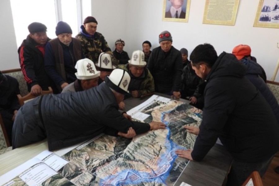
However, they express concern about its potential impact on livelihoods — primarily regarding access to pastures and the development of livestock farming, which is the main source of income for the population. The planned reservoir will flood more than 6,100 hectares, of which over 3,500 hectares are pasturelands. These lands are state-owned and have been leased to Electric Stations LLC.

Almost the entire territory within the flooding zone of the Kambarata HPP-1 has been officially leased to JSC Electric Stations. Previously, these lands were used by local ayil aimaks as winter and transitional pastures. Many residents possess pasture tickets, but do not have formal property rights — with the exception of three households, whose legal status requires further clarification.

Project Objectives & Goals

The project’s goal was to support solutions aimed at mitigating the impacts of pasture degradation and other livestock farming conditions in the ayil aimaks of Toluk, Sary-Kamysh, Elmirbek Imanaliev (formerly Nichke-Say), and Atay in the Jalal-Abad region. During the construction of the hydropower plant, the creation of a reservoir by means of a dam will lead to the flooding of parts of the ayil aimaks’ territories, and the environmental impact will be significant for the local ecosystem.

In this context, the project team was tasked with conducting an analysis of the socio-economic risks and developing recommendations for the restoration of pastures and income sources for the local population whose lands will be affected by the flooding.

Project Result

  • An analysis was conducted of the flooding area (approximately 6,125 hectares), of which more than 3,538 hectares are pastures vital for traditional winter grazing of livestock.
  • It is estimated that the project may affect over 1,000 households and around 6,000 people.
  • A Pasture and Livelihood Restoration Plan has been developed, including infrastructural measures (construction of bridges and roads) and social measures (training, microfinancing, development of alternative income sources).
  • Proposed measures amount to over USD 2.6 million, covering activities to ensure sustainable grazing, veterinary services, support for product processing, goat breeding development, and training.
  • Pasture maps have been prepared, seasonal grazing routes have been taken into account, and a pasture load analysis has been carried out.
  • For the first time, cultural sites and historical monuments within the flooding zone have been considered, and measures for their preservation have been proposed.